Weather
By Dan Skeldon
Well, we made it through what was likely the hottest stretch of the summer in South Jersey. From July 18th through July 25th, we sweated our way through an 8-day heat wave, which peaked with a 99-degree high temperature on Sunday, July 24th.
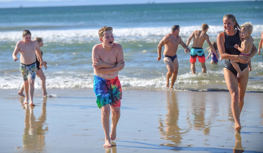
What’s a sure-fire way to beat the heat? Well for most of us, it’s either air conditioning, or a trip to the beaches. On the barrier islands, you can often bank on a sea-breeze shaving anywhere from a few to as many as 10-20 degrees off of the sizzling temperatures on the mainland.
And if the sea-breeze is stubborn to form and you’re instead fighting off scorching 90-something-degree temperatures on the sand (not to mention those pesky flies that ride an offshore breeze down to the beach), then there’s always the refreshing and inviting waters of the Atlantic.
After all, what’s not to love about the feel of 70-75° ocean water, which was the steady ocean temperature off of Atlantic City for the three days leading up to the heat wave. Locals know that the ocean warms slower than the land in the summer, hence that’s why the warmest ocean temperatures are usually around Labor Day. Conversely, it also cools slower in the winter too. Finally, ocean temperatures “usually” slowly rise and slowly fall, with not too many dramatic day-to-day swings.
But if you ventured a dip in the waters off of some South Jersey beaches during our recent 8-day heat wave, you may have been rudely awakened by a cold reality. The ocean temperature off of Atlantic City frequently dipped into the upper 50s during the heatwave, spending the better part of three days in the upper 50s, reaching temperatures as chilly as 57 degrees on multiple occasions. The reason: upwelling.
Yes, our ocean temperatures are “supposed” to follow a nice linear line, a slow rise through early September then a slow fall through mid-February. Then rinse and repeat. But a few things can interrupt this cycle, like stronger than usual cold or warm currents that deliver warmer or colder than normal water from other parts of the ocean for instance. But more than anything else, the aforementioned upwelling is the main driver behind sudden and sometimes dramatic temperature drops along the Jersey shore.
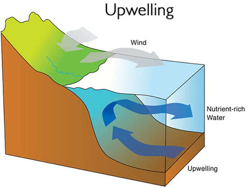
So what is it? Ultimately, it’s when winds blow the warmer and more shallow surface ocean water away from land, and colder water from the deeper ocean comes up to take its place. Along our coast, winds that come from the southwest are usually most effective at delivering the most notable upwelling events. Coincidentally, those same southwest winds are usually responsible for delivering the hottest and most humid weather of the summer as well. Put the two together, and yes, the ocean is more likely to be colder during the hottest days of the summer, though some years more than others depending on the strength and longevity of any one upwelling event.
Can we forecast an upwelling event? Well, yes and no. Yes, the wind direction is easy enough to forecast, as to how strong the winds will be and what direction they will come from. However, meteorologists don’t have the current ocean temperatures at all levels and depths. We don’t know how deep the warmer ocean surface water runs, and how deep and how chilly the colder ocean water is below. We also don’t know how effective those winds will be throughout an upwelling event.
While we can predict that some upwelling is likely, we’re not usually able to quantify just how strong and how long-lasting an event will be. Some can last a half a day, others for a week. Some can shave 5 degrees off the water temperature. On the flip side, I’ve seen our ocean drop from the low 80s one day to the mid 50s the next day, in a matter of 12 hours or so! Talk about a shock and how much of a difference one day can make!
So what are the favorable wind directions to bring in warmer water? Well, with the warm Gulf Stream current lying to our southeast, any winds that come from the southeast are usually the most prone to delivering a rise in our ocean temperature. Easterly winds can work as well, depending on the temperatures of the offshore water east of New Jersey and south of New England.
For warm water fans, the good news is that upwelling events are usually fleeting and not permanent. So in all likelihood, our late July upwelling should subside, and our ocean temperatures should stabilize back in the low 70s into early August. What happens through Labor Day though will remain highly dependent on which way the wind blows. And how strong it blows. And for how long.
Here’s hoping for some light southeast “trade winds” to deliver some tropical water through Labor Day. But no tropical storms. I’ll place that order with Mother Nature and let you know what I hear.
Meteorologist Dan Skeldon has a degree in meteorology from Cornell University. He has forecasted the weather in South Jersey for the last 18 years, first on the former television station NBC40 and then on Longport Media radio. Dan has earned the American Meteorological Society Seal of Approval for Broadcast Meteorologists, and now does television broadcasts on WFMZ-TV in Pennsylvania’s Lehigh Valley.